


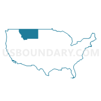
Northwest Montana--Kalispell City PUMA, Montana
About
Outline

Summary
| Unique Area Identifier | 193323 |
| Name | Northwest Montana--Kalispell City PUMA |
| State | Montana |
| Area (square miles) | 11,968.49 |
| Land Area (square miles) | 11,696.51 |
| Water Area (square miles) | 271.98 |
| % of Land Area | 97.73 |
| % of Water Area | 2.27 |
| Latitude of the Internal Point | 48.48062120 |
| Longtitude of the Internal Point | -114.17226450 |
Maps

Graphs
Select a template below for downloading or customizing gragh for Northwest Montana--Kalispell City PUMA, Montana


Neighbors
Neighoring Public Use Microdata Area (by Name) Neighboring Public Use Microdata Area on the Map
- Bonner, Latah, Shoshone, Boundary, Benewah & Kootenai (Southeast) Counties PUMA, ID
- North Central Montana--Great Falls City PUMA, MT
- Southwest Montana--Butte-Silver Bow & Helena City PUMA, MT
- West Montana--Missoula City PUMA, MT
Top 10 Neighboring County (by Population) Neighboring County on the Map
- Missoula County, MT (109,299)
- Flathead County, MT (90,928)
- Lewis and Clark County, MT (63,395)
- Bonner County, ID (40,877)
- Lake County, MT (28,746)
- Lincoln County, MT (19,687)
- Glacier County, MT (13,399)
- Sanders County, MT (11,413)
- Boundary County, ID (10,972)
- Powell County, MT (7,027)
Top 10 Neighboring County Subdivision (by Population) Neighboring County Subdivision on the Map
- Kalispell CCD, Flathead County, MT (39,230)
- Flathead Reservation CCD, Lake County, MT (25,580)
- Whitefish CCD, Flathead County, MT (12,996)
- Libby CCD, Lincoln County, MT (9,890)
- Blackfeet Reservation CCD, Glacier County, MT (9,560)
- Columbia Falls CCD, Flathead County, MT (8,895)
- Creston-Bigfork CCD, Flathead County, MT (8,372)
- Eureka CCD, Lincoln County, MT (6,221)
- Thompson Falls-West End CCD, Sanders County, MT (5,988)
- Lakeside-Somers CCD, Flathead County, MT (5,594)
Top 10 Neighboring Place (by Population) Neighboring Place on the Map
- Kalispell city, MT (19,927)
- Evergreen CDP, MT (7,616)
- Whitefish city, MT (6,357)
- Columbia Falls city, MT (4,688)
- Bigfork CDP, MT (4,270)
- Cut Bank city, MT (2,869)
- Lakeside CDP, MT (2,669)
- Libby city, MT (2,628)
- North Browning CDP, MT (2,408)
- South Browning CDP, MT (1,785)
Top 10 Neighboring Elementary School District (by Population) Neighboring Elementary School District on the Map
- Kalispell Elementary School District, MT (27,692)
- Columbia Falls Elementary School District, MT (14,331)
- Whitefish Elementary School District, MT (12,979)
- Polson Elementary School District, MT (9,949)
- Browning Elementary School District, MT (8,320)
- Somers Elementary School District, MT (6,311)
- Evergreen Elementary School District, MT (6,002)
- Bigfork Elementary School District, MT (5,747)
- Eureka Elementary School District, MT (4,902)
- Cut Bank Elementary School District, MT (4,406)
Top 10 Neighboring Secondary School District (by Population) Neighboring Secondary School District on the Map
- Missoula High School District, MT (100,417)
- Flathead High School District, MT (57,390)
- Columbia Falls High School District, MT (14,817)
- Whitefish High School District, MT (13,656)
- Polson High School District, MT (11,105)
- Browning High School District, MT (8,869)
- Bigfork High School District, MT (7,462)
- Powell County High School District, MT (7,226)
- Lincoln County High School District, MT (6,260)
- Cut Bank High School District, MT (4,530)
Top 10 Neighboring Unified School District (by Population) Neighboring Unified School District on the Map
- Lake Pend Oreille School District 84, ID (29,408)
- Boundary County School District 101, ID (10,972)
- Libby K-12 Schools, MT (9,844)
- Sunburst K-12 Schools, MT (1,232)
- Heart Butte K-12 Schools, MT (748)
Top 10 Neighboring State Legislative District Lower Chamber (by Population) Neighboring State Legislative District Lower Chamber on the Map
- State House District 1, ID (40,210)
- State House District 10, MT (13,774)
- State House District 6, MT (13,427)
- State House District 5, MT (11,824)
- State House District 11, MT (11,133)
- State House District 9, MT (10,874)
- State House District 2, MT (10,711)
- State House District 7, MT (10,572)
- State House District 3, MT (10,443)
- State House District 13, MT (10,394)
Top 10 Neighboring State Legislative District Upper Chamber (by Population) Neighboring State Legislative District Upper Chamber on the Map
- State Senate District 1, ID (40,210)
- State Senate District 3, MT (25,251)
- State Senate District 5, MT (24,648)
- State Senate District 6, MT (21,596)
- State Senate District 7, MT (20,946)
- State Senate District 2, MT (20,803)
- State Senate District 4, MT (20,558)
- State Senate District 1, MT (19,687)
- State Senate District 8, MT (19,081)
- State Senate District 46, MT (18,643)
Top 10 Neighboring 111th Congressional District (by Population) Neighboring 111th Congressional District on the Map
Top 10 Neighboring Census Tract (by Population) Neighboring Census Tract on the Map
- Census Tract 17, Flathead County, MT (8,115)
- Census Tract 8, Flathead County, MT (7,094)
- Census Tract 12, Flathead County, MT (7,025)
- Census Tract 9, Flathead County, MT (6,855)
- Census Tract 4, Lincoln County, MT (6,221)
- Census Tract 2, Sanders County, MT (5,988)
- Census Tract 7, Flathead County, MT (5,790)
- Census Tract 11, Flathead County, MT (5,755)
- Census Tract 9701, Boundary County, ID (5,647)
- Census Tract 14, Flathead County, MT (5,594)
Top 10 Neighboring 5-Digit ZIP Code Tabulation Area (by Population) Neighboring 5-Digit ZIP Code Tabulation Area on the Map
- 59901, MT (49,693)
- 59912, MT (13,499)
- 59937, MT (12,588)
- 59923, MT (9,856)
- 59417, MT (7,719)
- 59911, MT (7,678)
- 83805, ID (7,437)
- 59427, MT (4,757)
- 59917, MT (4,225)
- 59474, MT (3,820)